


|
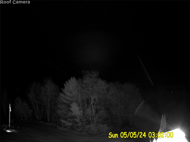 |
| Radar/Satellite images courtesy of NOAA/NWS and Weather Underground Click on image to go to radar page. | Weather Camera... |
|
METRIC |
IMPERIAL
|
Updated: 27-Apr-2024 @ 4:50am (0 sec ago) | |||||||||||||||||||||||||||||||||||||||||||||||||||||||||||||||||||||
| Temperature | Current Conditions | Forecast / Storm Prediction | ||||||||||||||||||||||||||||||||||||||||||||||||||||||||||||||||||||
|
|
|
||||||||||||||||||||||||||||||||||||||||||||||||||||||||||||||||||||
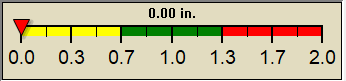
| Dew Point | Liquid Precipitation | Wind Speed | Sun/Moon | |||||||||||||||||||||||||||||||||||||||||||||||||||||||||||||||||||
|
|
|
|
|||||||||||||||||||||||||||||||||||||||||||||||||||||||||||||||||||
| Humidity | Barometer | |||||||||||||||||||||||||||||||||||||||||||||||||||||||||||||||||||||
|
|
|||||||||||||||||||||||||||||||||||||||||||||||||||||||||||||||||||||
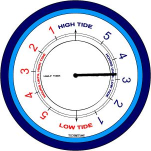
| Heating Degree Days | Tide | Wind Chill | Air | |||||||||||||||||||||||||||||||||||||||||||||||||||||||||||||||||||
|
|
|
|
|||||||||||||||||||||||||||||||||||||||||||||||||||||||||||||||||||
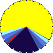
| UV Summary/Forecast | Solar Summary | |||||||||||||||||||||||||||||||||||||||||||||||||||||||||||||||||||||
|
|
|||||||||||||||||||||||||||||||||||||||||||||||||||||||||||||||||||||
| Almanac | Snow3 | Station All Time Records | Cloud Level | |||||||||||||||||||||||||||||||||||||||||||||||||||||||||||||||||||
|
|
|
|
|||||||||||||||||||||||||||||||||||||||||||||||||||||||||||||||||||


| 1 Rain season: Mar 1st to Nov 30th. 4 Updated at approx. 9:00 AM Eastern Time. 6 Air Quality Index is provided by Maine Department of Envriomental Protection and is updated hourly between the hours of 6AM and Midnight. 10 Historical average only to day 27 of just the month of April for this station since 2012. 11 Historical average rain this season to day 27 of April for this station since 2012. |
| NWS Weather Forecast - Outlook Overnight & Saturday | ||||||||||||||
|
||||||||||||||
|
||||||||||||||
|
||||||||||||||
|
ajax-dashboard6.php - Version 6.95h - 20-Feb-2023 - Script by: Scott of BurnsvilleWeatherLIVE.com Now supported by Saratoga-weather.org Download |
||||||||||||||


© 2024, South Turner Maine Weather |
Weather-Display (10.37S-(b150)) |
Valid
XHTML 1.0 |
Valid CSS
Tweet
Never base important decisions on this or any weather information obtained from the Internet.
Tweet
Never base important decisions on this or any weather information obtained from the Internet.
Never base important decisions on this or any weather information obtained from the Internet.