| Dawn: | Sun Rise: | Moon Rise: | 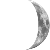 Visible % Visible % |
|||
| Dusk: | Sun Set: | Moon Set: | ||||
| Daylight: | Day Length: | Moon Phase: | ||||
| Current conditions: | ||||||
| Temperature and Humidity | |||
| Temperature | Dew Point | ||
| Windchill | Humidity | % | |
| Heat Index | Apparent TemperatureFeels Like | ||
| Temp change last hour | |||
| Rainfall | |||
| Rainfall Today | Rainfall Rate | /hr | |
| Rainfall This Month | Rainfall This Year | ||
| Rainfall Last Hour | Last rainfall | ||
| Rainfall Since Midnight | Rainfall Last 24 Hours | ||
| Wind | |||
| Wind Speed (gust) | Wind Speed (avg) | ||
| Wind Bearing | ° | Beaufort | |
| Wind Variation (last 10 minutes) | From ° to ° | ||
| Pressure (sea level) | |||
| Barometer | /hr | ||
| Solar | |||
| Solar Radiation | W/m² | Evapotranspiration Today | |
| UV Index | |||
Page updated .
The weather station in use is the
This page is updated every minutes. The meteorological day used at this station ends at .
Forecast: